Voree, Wisconsin · 1844–1850
Walk through
historic Voree.
The Hill of Promise. The stone houses. The Temple, the White River, and the records of a community that remained in the Midwest.
A photographic tour by John Hajicek.
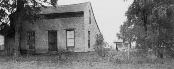
Voree lies immediately west of Burlington, Wisconsin, near the White River and Mormon Road, on the Racine–Walworth County line. From 1844 to 1850, thousands of Mormons gathered here with James Strang. Follow the photographs through the settlement; each image opens at its original available resolution.
Map of the Midwestern gathering places
Between 1830 and 1856, Mormons had gathering places called “stakes of Zion,” which were holy places where they were commanded to live. All of them were located in the Midwest.

Mormon Park and the Hill of Promise
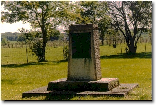
Start your tour at the center of Voree in the Mormon Park, where the Burlington Historical Society has erected a monument
Open original image ↗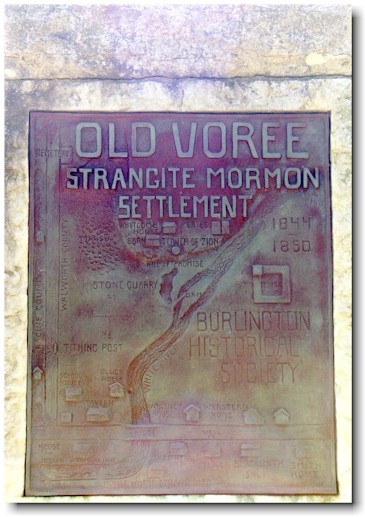
Bronze plaque with a map of Voree on one side of monument
Open original image ↗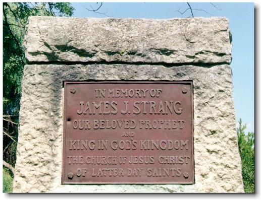
Other side of the monument has a memorial to the church
Open original image ↗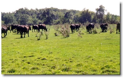
Nearby Hill of Promise, where the prophet James and witnesses unearthed brass plates
Open original image ↗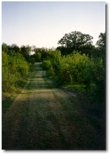
Walk or drive the lane up the hill to the sacred sites
Open original image ↗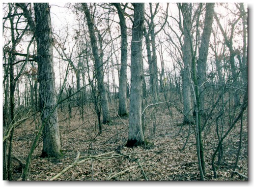
Without foliage in the fall you can discern the slope of the hill
Open original image ↗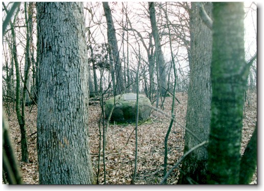
In the grove you can find a granite rock with a brass plaque commemorating the spot where the ancient record was found
Open original image ↗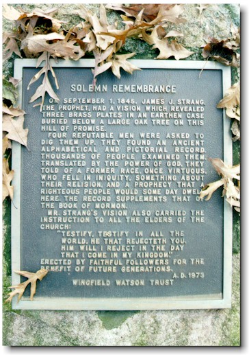
Plaque summarizes the account of the history of the discovery under an oak tree
Open original image ↗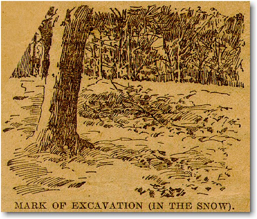
Depression where plates were dug still visible through the snow in this 1897 engraving
Open original image ↗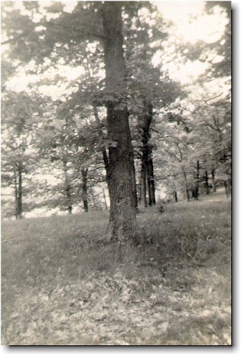
Blazed tree showing area near where plates were found, from a negative made about 1905
Open original image ↗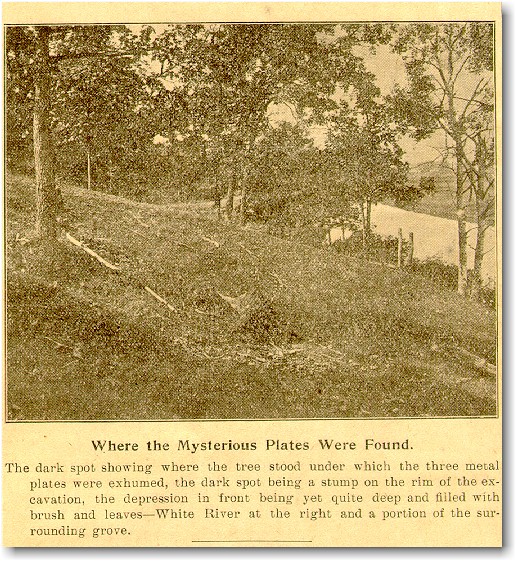
Hole where tree was removed and the plates were found, from a 1906 newspaper photograph
Open original image ↗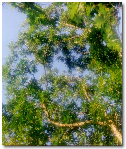
Looking up in September you can see the silhouette of oak leaves in the sky
Open original image ↗
Facsimile of the Voree plates, from an 1847 woodcut broadside
Open original image ↗Stone houses, printing, and the quarry
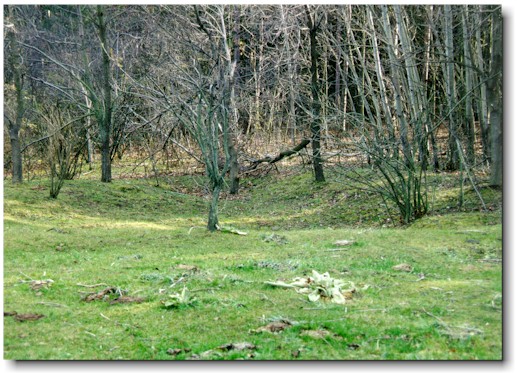
All over you can find impressions of former dwellings, barns, and the sacred Tower of Zion built at the top of the hill
Open original image ↗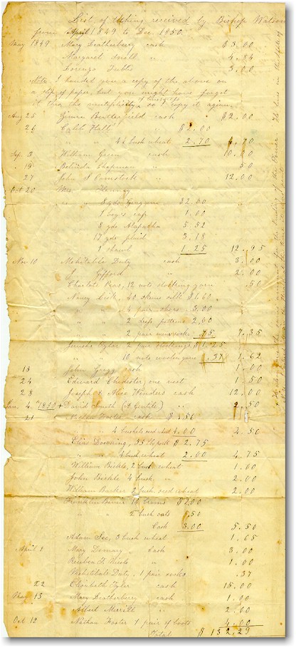
The Tower of Zion was paid for by contributions as shown in this Voree tithing record conveyed by the bishop Gilbert Watson to the prophet James
Open original image ↗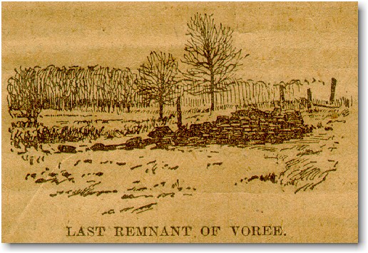
Once the foundations were visible too, as in this 1897 engraving
Open original image ↗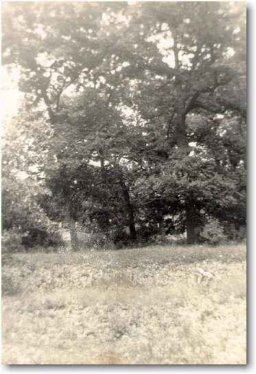
This photo taken about 1905 shows a deeper excavation than is visible today
Open original image ↗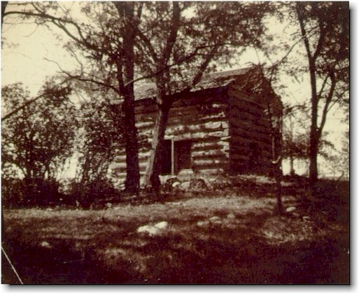
Most habitations were tiny board cabins over dugouts in the hill, probably not as fancy as this nearby Aldrich family cabin
Open original image ↗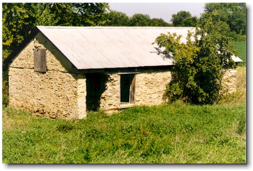
This sheep shed has lathe and plaster inside from its days as a hand-hewn stone house
Open original image ↗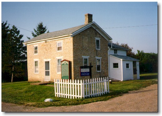
Fine hand-hewn stone house on Mormon Road, saved from bulldozing by John Hajicek
Open original image ↗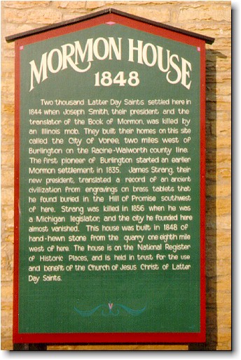
Wooden sign that is close enough for motorists to read on Mormon Road
Open original image ↗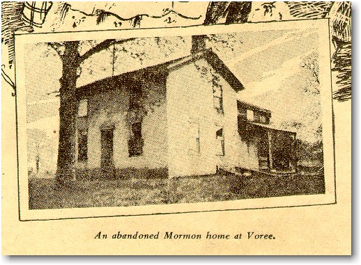
Mormon Road house, already abandoned in a 1927 newspaper photograph
Open original image ↗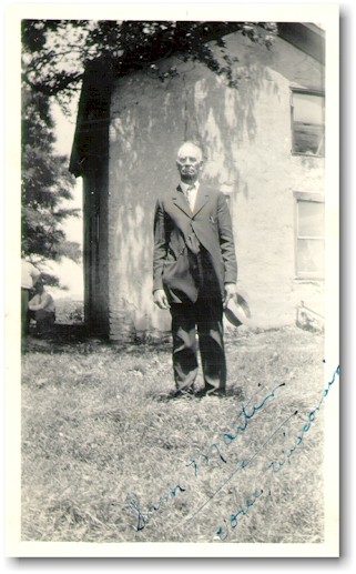
Mormon standing near the Mormon Road house in this 1928 photograph—notice the other Mormons sitting on the step
Open original image ↗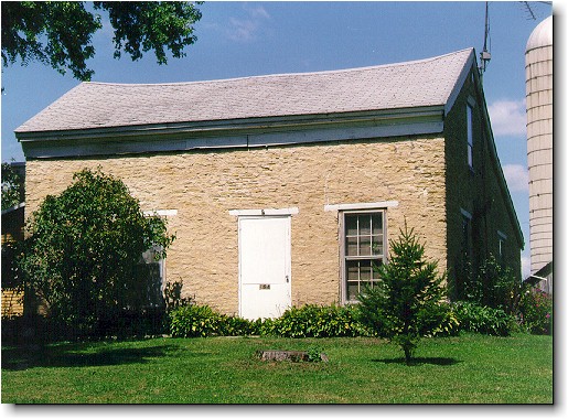
Hand-hewn stone house where the Voree Herald was printed and the prophet James died when he was martyred—the bow in the roof has been there since the 1800s
Open original image ↗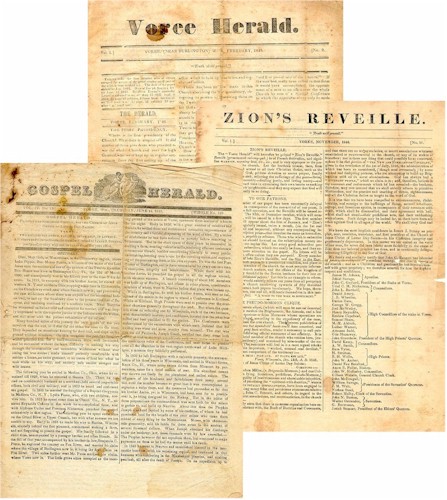
Copies of the Voree Herald and other church newspapers printed in Voree 1846–1850
Open original image ↗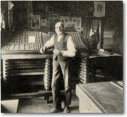
Francis Cooper, who edited the Voree Herald in the 1840s, shown here still typesetting in the next century
Open original image ↗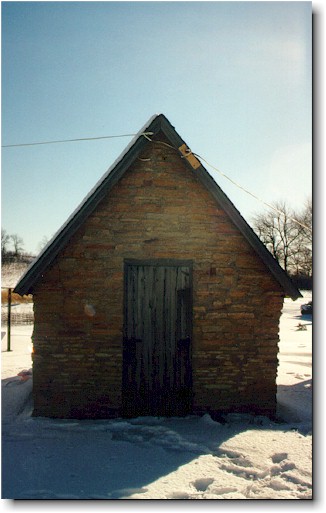
Archives where the sacred church records have been kept during most of this century
Open original image ↗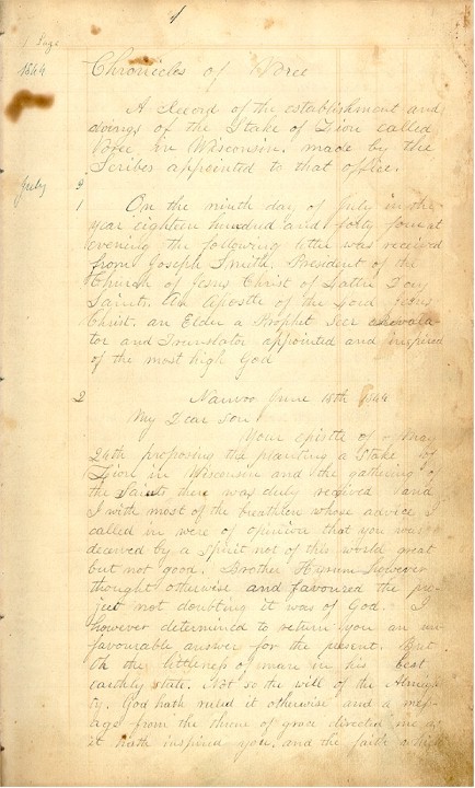
Chronicles of Voree, the manuscript record of the appointment of James by the prophet Joseph, found in the stone Archives
Open original image ↗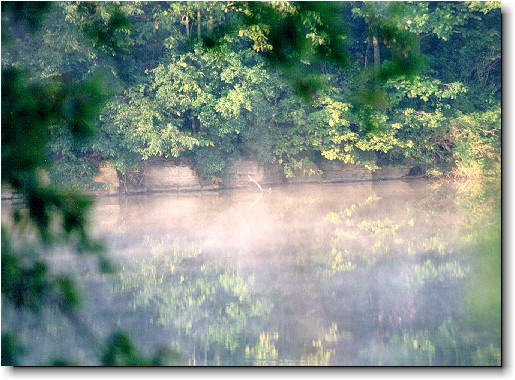
Stone quarry reflection on the water, where the Mormons cut their stone for their houses, Tower of Zion, and Temple
Open original image ↗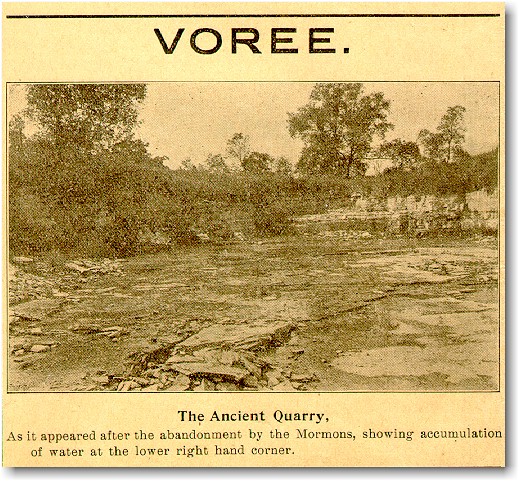
The Mormon quarry as it looked in a 1906 newspaper photograph
Open original image ↗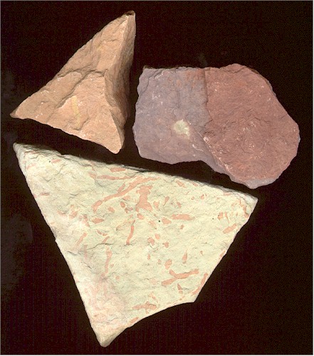
Minerals in the quarry such as iron, copper, and zinc have tinted this unpolished marble in brilliant colors
Open original image ↗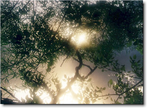
Silhouette of plant life near the quarry
Open original image ↗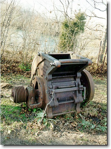
Abandoned gravel pulverizer near the quarry
Open original image ↗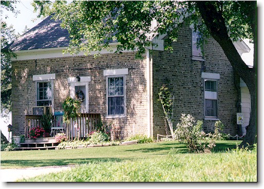
Lake-stone house with cream city brick quoins, which may have been the home of Lemuel Smith—church preaching was done in his barn in the 1840s
Open original image ↗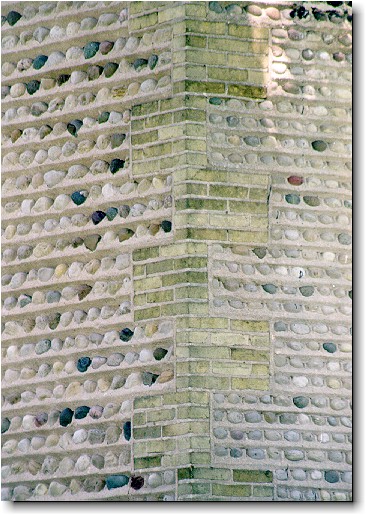
Detail of architecture by artisans from the Erie Canal in New York—the most uniform stones were sorted for the front, less perfect ones on the ends, and least desirable ones in the back—intricate trowel work set the stones into place
Open original image ↗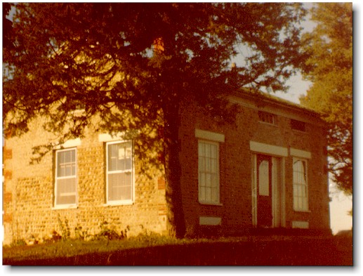
Lake-stone house with red brick quoins, which was the home of Alma Aldrich until it burned years ago
Open original image ↗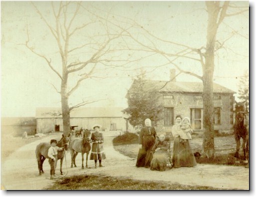
View of the Aldrich home in years past
Open original image ↗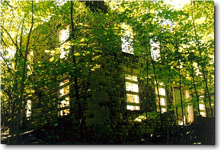
House with rows of granite rocks, white limestone quoins, and cream city brick window and door lintels—abandoned west of Voree almost to North-Lyons Road on Highway 11
Open original image ↗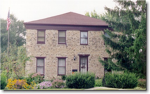
Lake-stone house between Burlington and Voree with cream city brick quoins, with most uniformly small stones near the bottom
Open original image ↗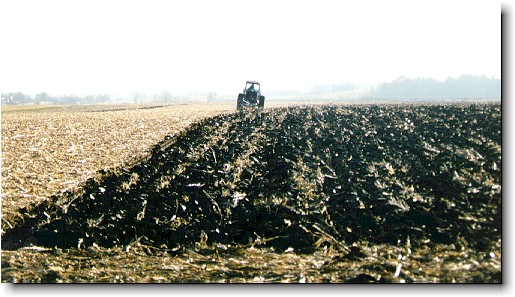
Farmer tilling the black soil where Mormons used to use plow horses—there is a local gentile legend that the soil in Voree is so rich that if you plant nails in the morning you will have fence posts by evening
Open original image ↗The Temple and the White River
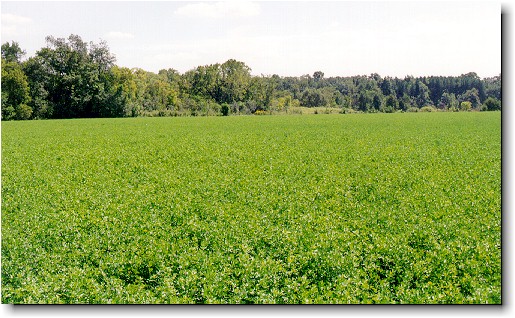
View of temple lot from the northwest
Open original image ↗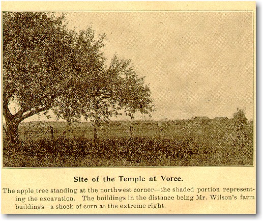
Looking the other direction in a 1906 newspaper photograph
Open original image ↗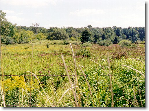
View from temple lot looking south
Open original image ↗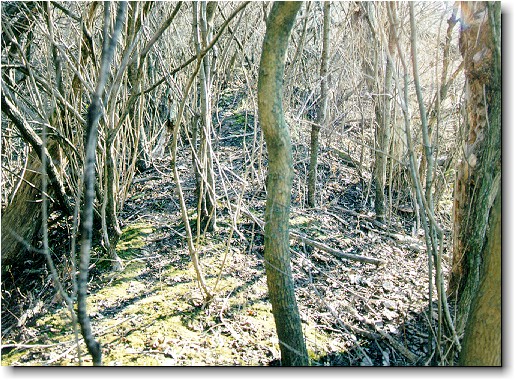
Deer path along a ridge of stone that may be the temple foundation
Open original image ↗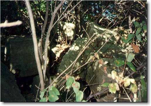
Stone pieces that may be old enough to be temple ruins
Open original image ↗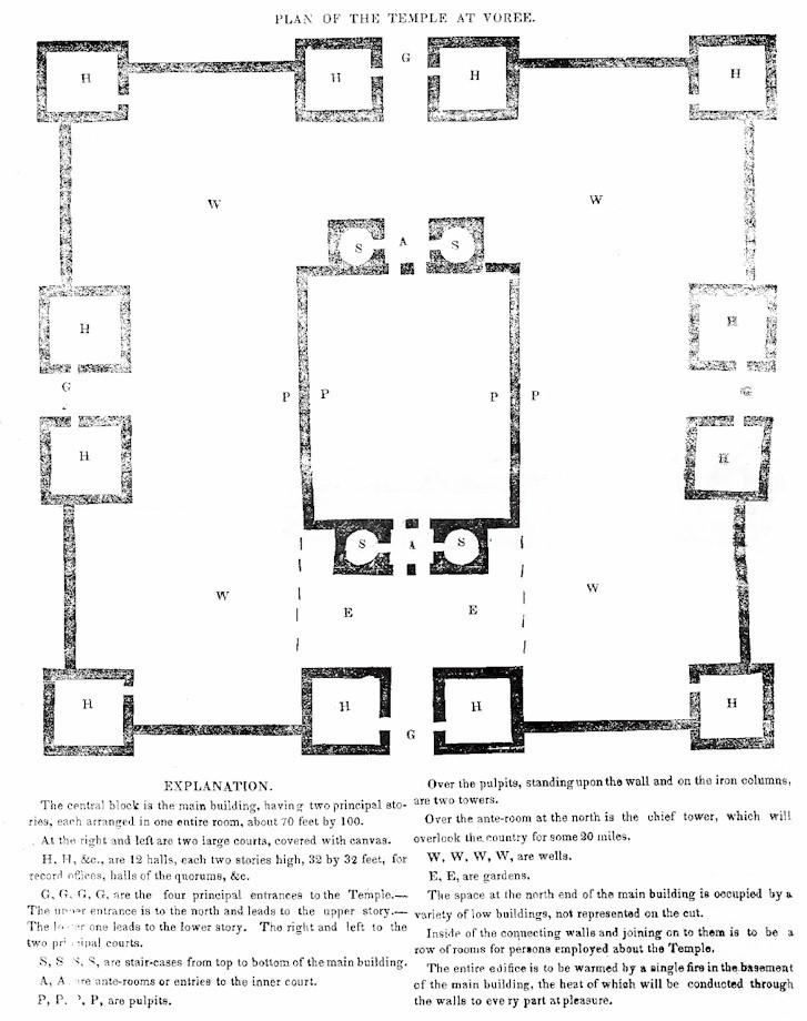
Floor plan of the Voree temple complex, which had a walk-out lower-level facing the White River on the south
Open original image ↗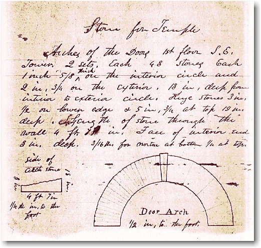
Details of the Voree temple in the handwriting of the prophet James, now at Yale University
Open original image ↗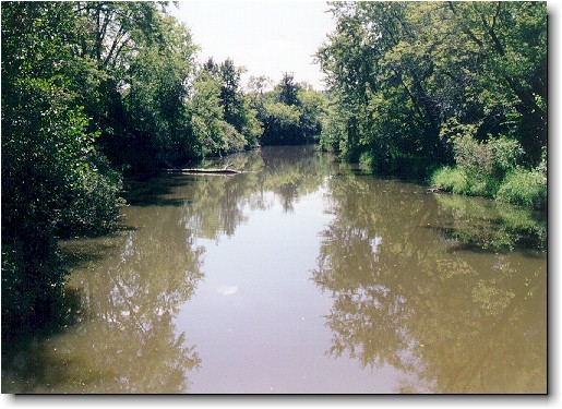
White River where Mormons did their baptizing for the dead, looking south from the bridge
Open original image ↗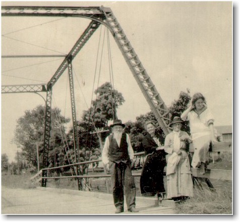
Wingfield Watson and his Mormon family on the White River bridge about 1910
Open original image ↗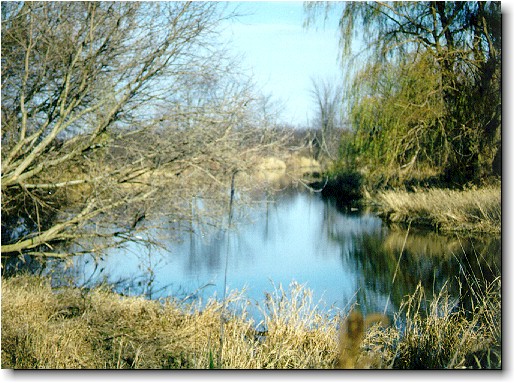
White River looking north from the bridge
Open original image ↗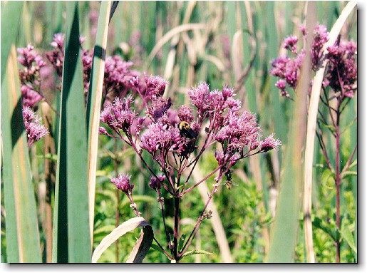
Close-up of nature near the White River
Open original image ↗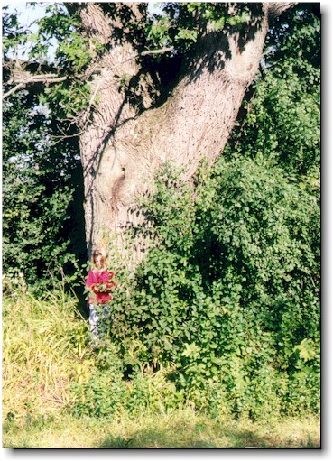
Mormon child demonstrating how large the oak trees are along Mormon Road, where they lined the street before the road was widened
Open original image ↗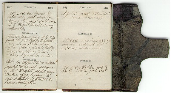
Diary of Edward Chidester, who chronicled the martyrdom of the prophet James
Open original image ↗The cemetery and surrounding farms
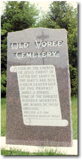
Monument in the Voree cemetery where the prophet James was buried after his martyrdom
Open original image ↗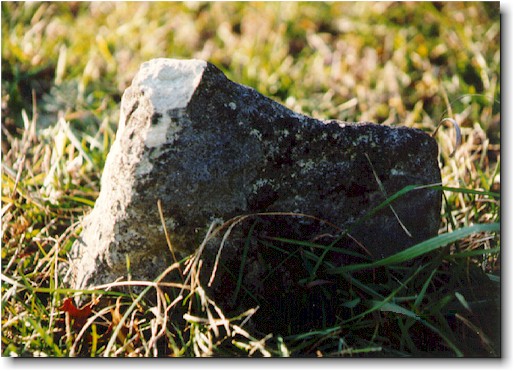
Single remaining tombstone in the Voree cemetery
Open original image ↗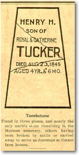
Single tombstone as it looked in a 1906 newspaper photograph
Open original image ↗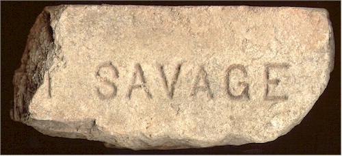
A piece of Voree marble tombstone recovered from a nearby doorstep when a house was bulldozed
Open original image ↗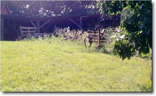
Farm buildings and implements on the cemetery
Open original image ↗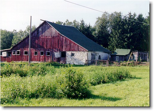
Red barn built over the white-washed limestone of a Mormon-period building near the cemetery
Open original image ↗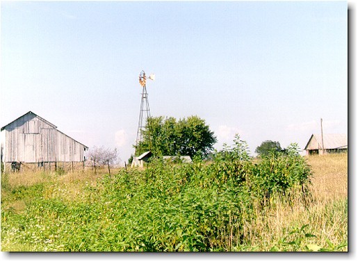
Gray weathered barn on quarry stone foundation
Open original image ↗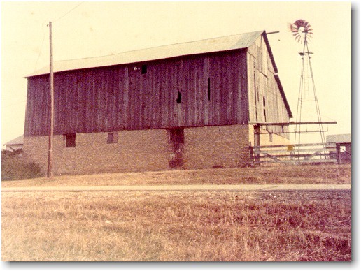
Gray barn with closer view of massive foundation
Open original image ↗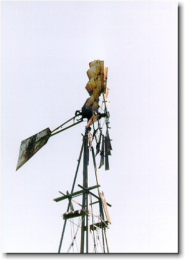
Close up of rusty windmill
Open original image ↗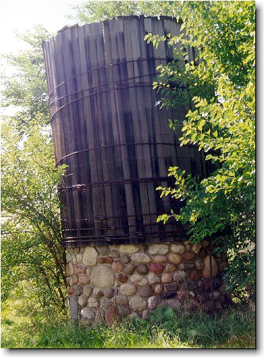
Granite and wood silo near Voree
Open original image ↗Families, homes, and neighboring communities
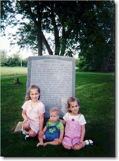
Memorial to Wingfield Watson with Mormon children in park-like setting
Open original image ↗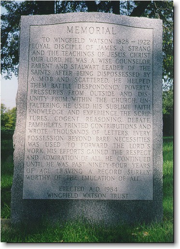
Close-up of Memorial to Wingfield Watson
Open original image ↗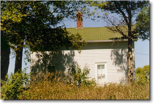
Original Wingfield Watson house on the first Mormon trust farm near North-Lyons Road and Highway 11
Open original image ↗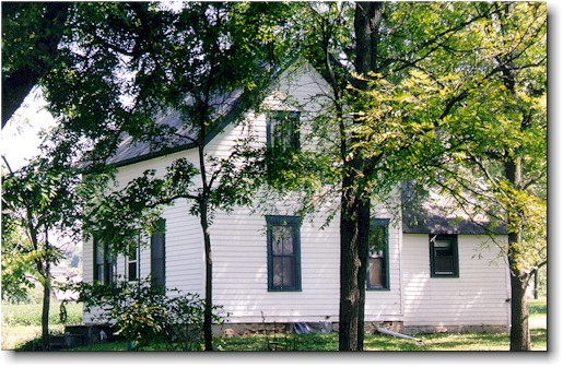
Later Wingfield Watson house near Mormon Road and Highway 11 in the center of Voree
Open original image ↗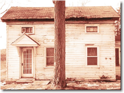
Wood frame house no longer standing from Mormon era
Open original image ↗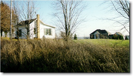
Small wood house beside modern prosperity in the area
Open original image ↗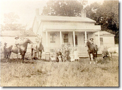
Early church prophecies say that Voree would be built on Gardner’s Prairie. Here is the original Palmer Gardner house, still standing on Highway DD—courtesy of Ralph Wilson
Open original image ↗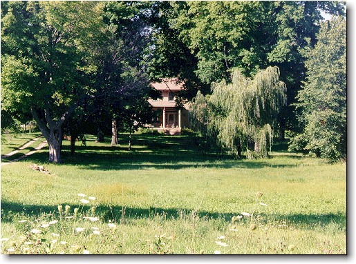
House built of Mormon quarry stone on Spring Prairie Road by a famous Wisconsin horticulturist
Open original image ↗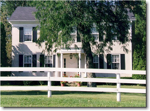
House at the corner of Beineman Road and Spring Prairie Road built of stucco over Mormon quarry stone
Open original image ↗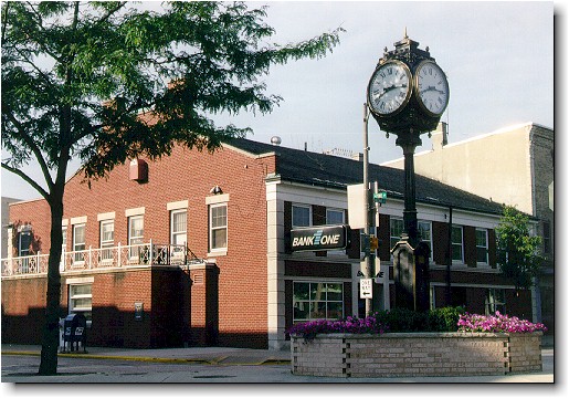
Building which housed the law offices of Caleb Barnes in 1847, who had earlier been law partners with the prophet James, and where James afterwards frequented
Open original image ↗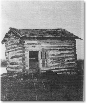
Cabin of Moses Smith, Wisconsin’s first Mormon in 1835. He was a friend and business associate of Joseph Smith, and ran a Nauvoo general store like the prophet Joseph (courtesy of the Burlington Historical Society)
Open original image ↗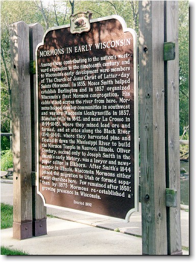
Utah-viewpoint monument in Echo Lake Park in Burlington, which does not mention the prophet James whatsoever, but memorializes Moses Smith (who was an apostle under the prophet James and not a follower of Brigham)
Open original image ↗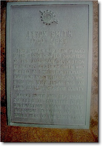
Daughters of the American Revolution monument to Aaron Smith, the father of Moses Smith
Open original image ↗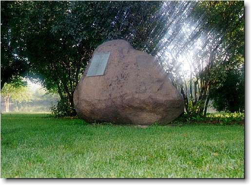
Distant view of the Aaron Smith monument in Wagner Park in Burlington
Open original image ↗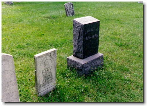
Burlington Cemetery where the prophet James was directed to be moved, and where other early leaders are buried
Open original image ↗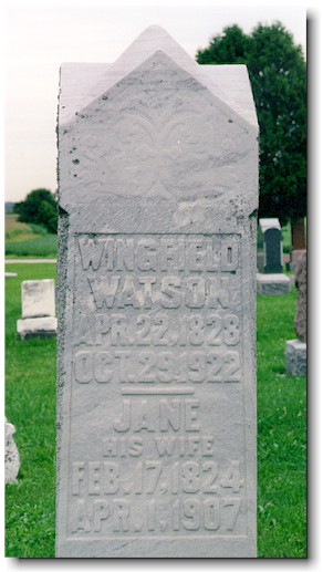
Hudson Cemetery in nearby Lyons Township, where the second generation of Mormons was buried beginning with Wingfield Watson
Open original image ↗The meeting house and Voree Press
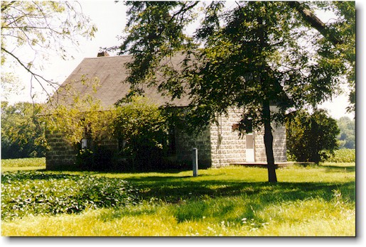
Voree meeting house viewed from the corner of Mormon Road and Highway 11, built in 1927
Open original image ↗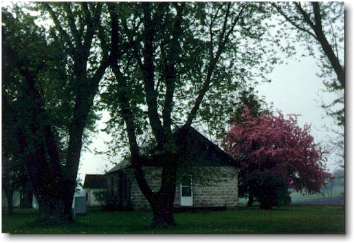
Voree meeting house with spring flowers
Open original image ↗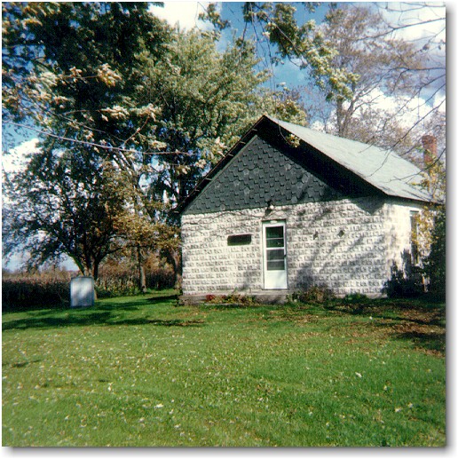
Voree meeting house in park-like setting
Open original image ↗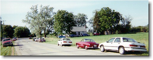
Visitor’s automobiles parked along Mormon Road near the Voree meeting house
Open original image ↗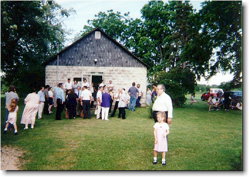
Visitors gathered outside the Voree meeting house
Open original image ↗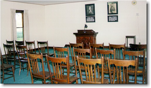
Inside look at the Voree meeting house, changed little since 1927
Open original image ↗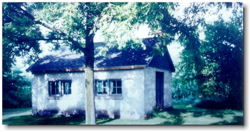
1948 Mormon print shop, the Voree Press, where the 336 page Book of the Law of the Lord was reprinted in 1948-49, as well as the 1950 Diamond.
Open original image ↗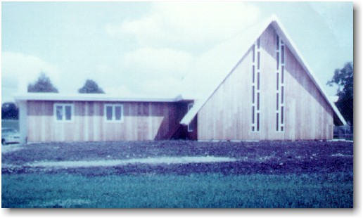
A building on Spring Valley Road where a modern Mormon group meets after forming a new organization in 1961
Open original image ↗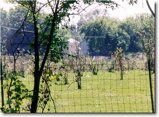
Departing view of Voree
Open original image ↗Portraits, manuscripts, and rare imprints

Only located daguerreotype image of the prophet James, scanned directly from the original
Open original image ↗
High resolution magnification of the prophet James—the closest you will ever get to looking directly into the eyes of the only prophet ever to be photographed
Open original image ↗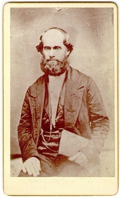
Prophet James holding book, from a cabinet card
Open original image ↗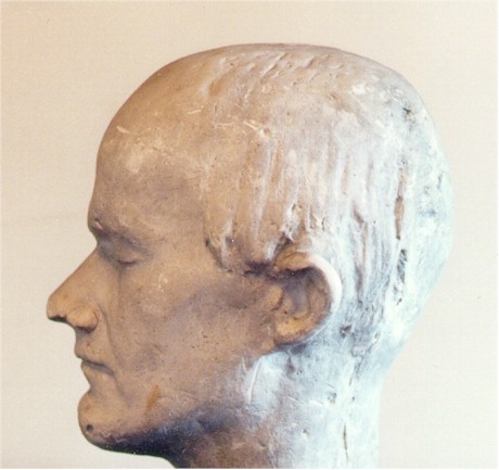
Life-mask casting of the face of the prophet James without a beard, in historical society collection
Open original image ↗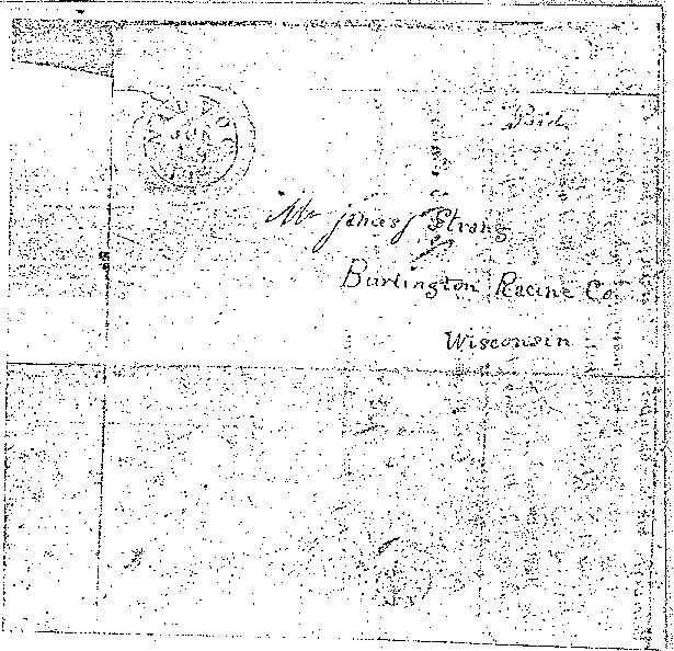
Letter of Appointment, envelope. From Joseph Smith to James Strang, dated at Nauvoo, Illinois, June 18, 1844, and postmarked the next day. This is the facsimile that Yale University will mail to you upon request
Open original image ↗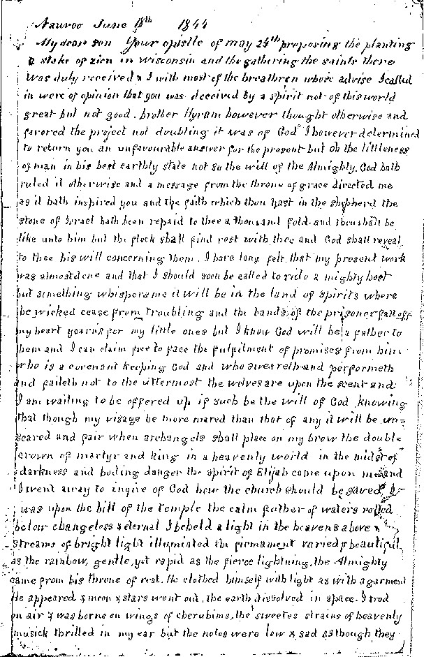
Letter of Appointment, page 1
Open original image ↗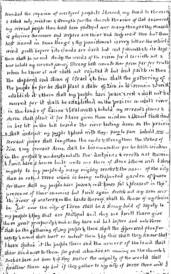
Letter of Appointment, page 2
Open original image ↗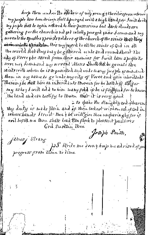
Letter of Appointment, page 3
Open original image ↗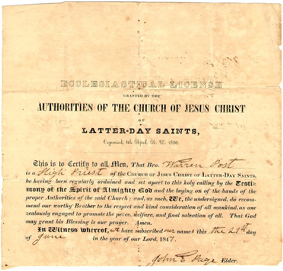
License given to the hundreds of Mormon preachers who visited Voree
Open original image ↗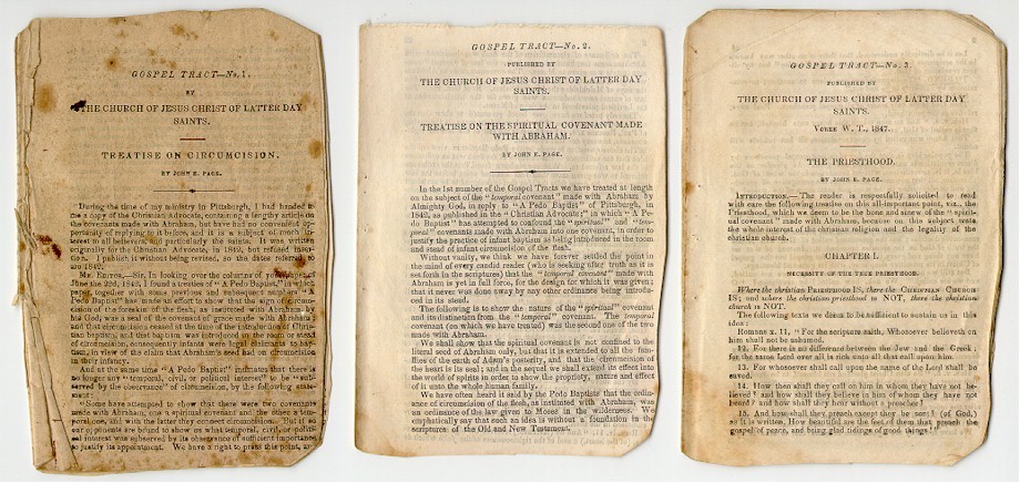
Gospel Tracts, 1–4, printed in Voree by John E. Page, who was an apostle under both prophets Joseph and James
Open original image ↗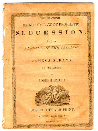
Diamond, an 1848 tract printed at Voree with the presidential succession documentation
Open original image ↗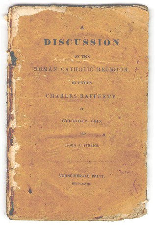
Catholic Discussion, an 1847 tract printed at Voree to discuss the nature of God
Open original image ↗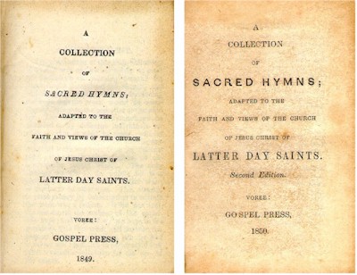
Hymns, printed at Voree (the little Mormon church in Voree printed two hymn books before one was ever printed by the Utah-based church in America)
Open original image ↗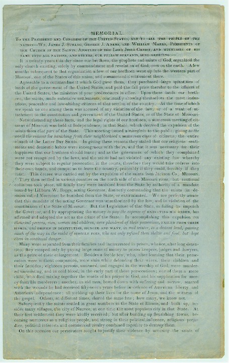
Memorial to Congress, printed when the Mormons were leaving Voree to go to Beaver Island, Lake Michigan, in 1850
Open original image ↗Photography and original evidence
Original tour photography, scanning, cropping, image editing, and graphic design: John Hajicek. Opening historical photograph: Wisconsin Historical Society, WHi 29671; PF Burlington.23; 1915; photographer unidentified. Modern photographs are preserved in John Hajicek’s digital archives. Rare imprints, manuscripts, and museum artifacts are in the Hajicek collection unless otherwise noted. Individual source credits are retained in the captions.
Original tour editions: 1999 and 2001. Presentation revised November 13, 2026.
For historical inquiries, call John Hajicek: 816-536-3142.